
Shop
Lake Eyre Basin Map
AIATSIS / Peter Campbell Design
Design
A ‘Living Treasure’ (Brenda Shields)
This is one of the most important design projects we ever had the honour of working on.
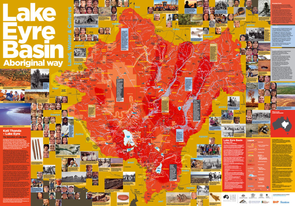
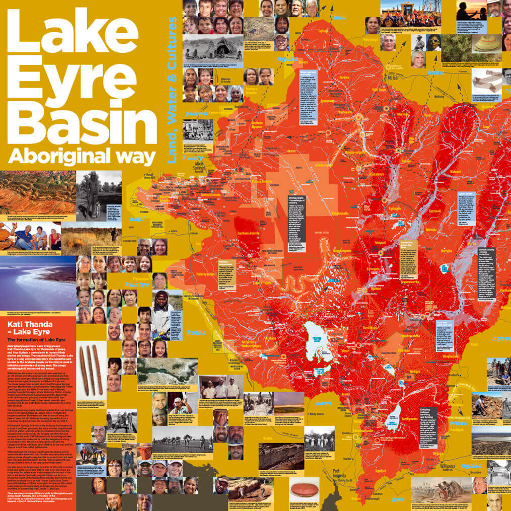
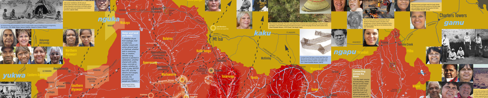
The Lake Eyre Basin covers 1.2 million square kilometres across inland Australia — almost one-sixth of the country – and has been home to many Aboriginal nations for many thousands of years.
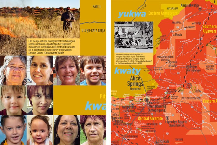
Physical evidence of Aboriginal occupation exists throughout the Basin, including artefacts, campsites, middens, stone arrangements, burial sites, paintings and engravings. Indeed, many Aboriginal people live on country as their ancestors have done since time immemorial. Others might live further away but still maintain a strong connection to their country.
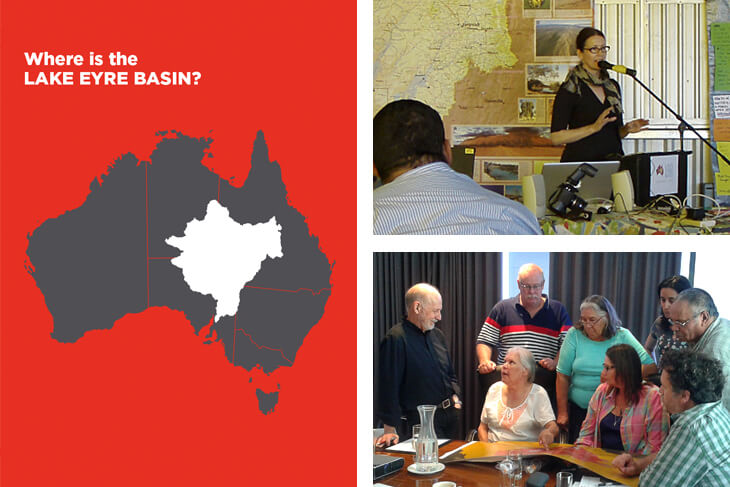
The plan for the map was first laid out at the 2006 Lake Eyre Basin Aboriginal Forum, and a national tender undertake the design of a large (1000mm x 700mm) educational map celebrating the richness, diversity and vibrancy of Aboriginal cultures across the Basin was published in 2011. We won this tender (as CampbellBarnett – with our wonderful Design Director Lea Barnett) and were subsequently engaged to undertake the design of a large (1000mm x 700mm) educational map celebrating the richness, diversity and vibrancy of Aboriginal cultures across the Basin.
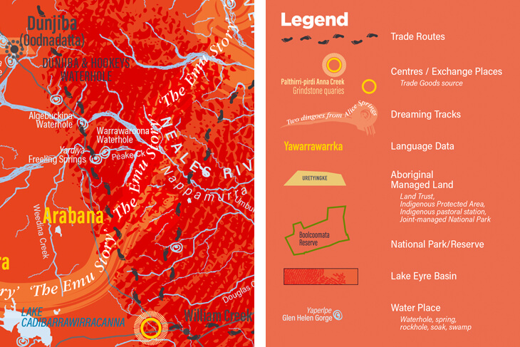
Originally intended to take just six months, this fascinating project was developed and refined over the next three years. Complex layers of information were visualised, plotted and digitised to build up an exciting overview of Aboriginality in the Basin. In 2015, after a hiatus of nearly 12 months, the project gathered speed and the painstaking process of consultations with the elders, approvals and refinement began. The map, which was finally completed and launched in August 2018, features songlines, historical trade routes and other cultural information about the basin, which covers 71 language groups.
Based on Aboriginal culture and law, and with the cooperation of all of the Aboriginal tribes in the basin, it shows the living, breathing, eating and trading on country, and sharing stories and culture in general.
A large number of physical maps were printed and sold throughout the basin and beyond. This run has now sold out with no plans to reprint but I have the approval of AIATSIS to distribute a digital version of the map to anybody that is interested – free of charge.
PLEASE.. contact me HERE and I will send a high resolution PDF and JPG to you electronically – FREE OF CHARGE.
Lake Eyre Basin Aboriginal Map
DETAILS
AUTHOR / Lake Eyre Basin Aboriginal Forum
DESIGNER / Peter Campbell Design / CampbellBarnett
PUBLISHER / AIATSIS
YEAR OF PUBLICATION / 2018
FORMAT / Digital file (originally a physical map, 1000mm x 700mm)
AVAILABILITY / Free Digital Download courtesy of AIATSIS